Key takeaways:
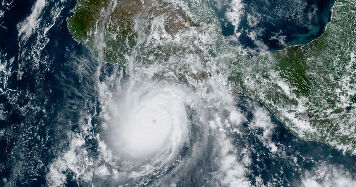
- Hurricane Otis made landfall as a catastrophic Category 5 hurricane with 165 mph (170 kmh) winds and heavy rain.
- The storm explosively intensified by about 115 mph in just 24 hours, making it only the second storm in recorded history to eclipse that mark.
- Residents of Guerrero’s coast scrambled to prepare, with the National Hurricane Center continuing to monitor the situation and provide updates.
Residents of Mexico’s southern Pacific coast were caught off guard Wednesday morning as Hurricane Otis made landfall as a catastrophic Category 5 hurricane. With 165 mph (170 kmh) winds and heavy rain, the storm stirred memories of a 1997 storm that killed dozens of people.
The National Hurricane Center called this a “nightmare scenario” for southern Mexico, as the hurricane “explosively intensified” by about 115 mph in just 24 hours. Only one other storm in recorded history, 2015’s Hurricane Patricia, has eclipsed that mark.
Brian McNoldy, a senior research associate at the University of Miami Rosenstiel School of Marine, Atmospheric and Earth Science, commented on the rapid intensification of the storm. “Imagine starting your day expecting a stiff breeze and some rain, and overnight you get catastrophic 165 mph winds,” he wrote.
The five to 10 inches of rain forecast, with as much as 15 inches possible in some areas, raised the threat of landslides and floods. Residents of Guerrero’s coast scrambled to prepare, but the storm’s sudden intensity appeared to catch many off guard.
The National Hurricane Center is continuing to monitor the situation and provide updates as needed. Follow along for live coverage here.


Be First to Comment