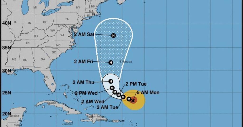
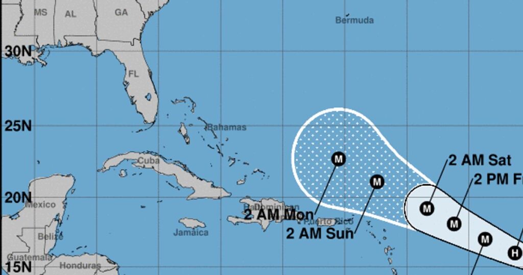
Hurricane Lee is intensifying in the western Atlantic, causing hazardous surf and rip current conditions along the southeastern US coast which will spread northward in the coming days. The storm is predicted to remain a major hurricane this week and pass between Bermuda and the East Coast by the end of the week, staying offshore of New York City. Residents are advised to take precautions and stay informed of the latest updates from the National Hurricane Center.
Posts tagged as “the Leeward Island”
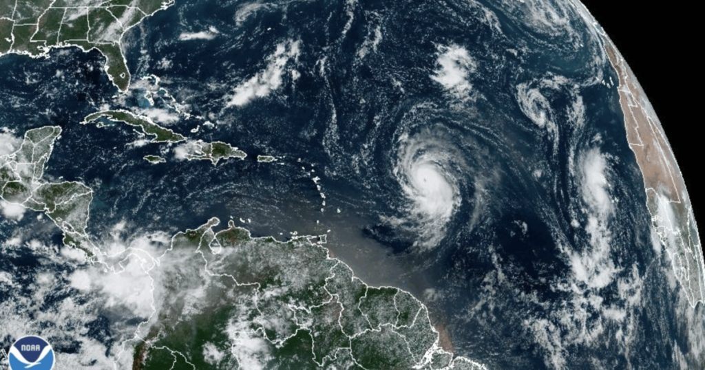
Hurricane Lee has explosively intensified into a Category 5 storm in the central tropical Atlantic Ocean, packing winds of up to 160 miles per hour and expected to remain a major hurricane through early next week. Tropical storm conditions are possible on some islands, although the hurricane is not expected to make landfall. Residents in the Caribbean are advised to monitor the storm and take necessary precautions.
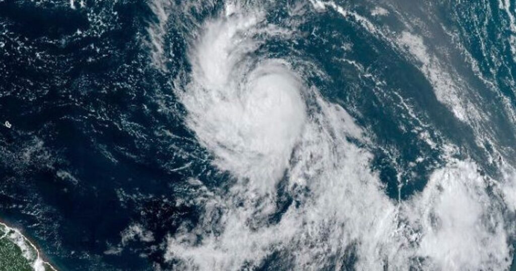
The National Hurricane Center (NHC) has issued a warning that Tropical Storm Lee is expected to rapidly intensify and become an “extremely dangerous major hurricane” by early Friday. Forecasters predict that Lee will intensify into a Category 4 hurricane with winds potentially as high as 155 mph, and the NHC is advising residents of the Leeward Islands to monitor the storm and take necessary precautions to protect themselves and their property. Residents are urged to stay informed and follow the instructions of local officials.
Tropical Storm Lee has formed in the Atlantic Ocean and is expected to become a major hurricane by the end of the week. It is located 1,230 miles east of the Lesser Antilles and is moving west-northwest at 14 mph (22 kph). The National Hurricane Center is urging people in the Caribbean to monitor the storm's progress and to be prepared for potential impacts. This is the twelfth named storm of the 2021 Atlantic hurricane season, which is expected to be an active one.