Key takeaways:
- Isaias was a Category 1 hurricane with sustained winds of 85 mph late Thursday morning.
- Florida declared an emergency in 25 counties and Alabama in 40, while parts of Florida’s Okaloosa County faced mandatory evacuation.
- Forecasters expect 3 to 7 inches of rain across parts of the Gulf Coast, with localized totals up to 15 inches.
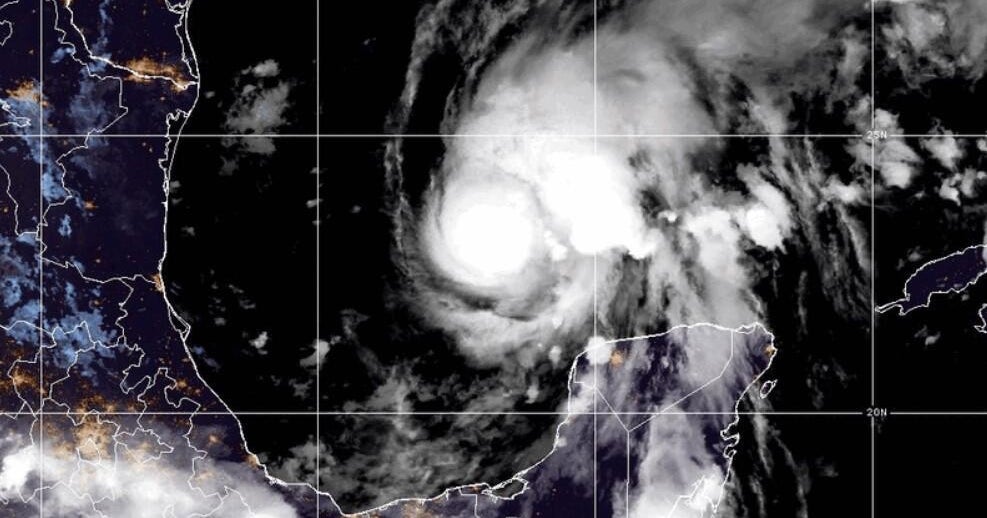
Hurricane Isaias strengthened Thursday as it moved toward the northern Gulf Coast, where forecasters warned of life-threatening storm surge, damaging winds and flooding when it makes landfall late Friday or early Saturday. Officials ordered evacuations in parts of Florida and urged coastal residents to finish preparing.
The first hurricane of the 2026 Atlantic season, Isaias grew from a tropical storm late Wednesday. By 11 a.m. Eastern time Thursday, its sustained winds had reached 85 mph, and its center was about 380 miles south of the mouth of the Mississippi River, according to the National Hurricane Center. Hurricane-force winds extended up to 15 miles from the center, with tropical-storm-force winds reaching up to 90 miles.
“Additional strengthening is expected through early Friday, and Isaias should remain a dangerous hurricane as it approaches the northern Gulf Coast on Friday night,” the center said. It urged people in the warning area to rush preparations to protect life and property.
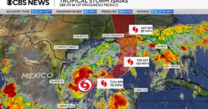
Hurricane warnings covered parts of the Mississippi, Alabama and Florida coasts. Storm surge warnings stretched from the mouth of the Mississippi River across the coasts of Mississippi and Alabama into Florida, while tropical storm warnings covered additional coastal areas. The National Weather Service urged residents under storm surge warnings to follow local officials’ advice and evacuate if told to do so. It also warned of possible long-duration power outages.
Florida Gov. Ron DeSantis declared a state of emergency for 25 counties, and Alabama Gov. Kay Ivey issued one for 40 counties. In Florida’s Okaloosa County, mandatory evacuations for some coastal areas were set to begin at noon Eastern time Thursday. Voluntary evacuations were in place in coastal southeastern Alabama, where Gulf Shores officials urged nonresidents to leave to reduce congestion and support emergency operations.
Dauphin Island Mayor Jeff Collier told CBS News that his biggest concern was whether residents and visitors would act on the warnings. “Because what inevitably happens is people hear the warnings, but they don’t actually take any action until it’s much too late,” he said. “And oftentimes if it’s really bad, first responders can’t get out to people until things calm down a bit.”
Forecasters expect 3 to 7 inches of rain along a broad stretch of the Gulf Coast, with localized totals as high as 15 inches, particularly in parts of the Florida Panhandle and Big Bend. Heavy rain could cause flash, urban and river flooding. Tornadoes are possible Friday night in coastal Alabama, the Florida Panhandle and southwestern Georgia, with the threat extending into Saturday in parts of the Southeast.
Several school districts in Alabama and Florida announced closures, The Guardian reported. The Federal Aviation Administration warned that the storm could lead to Gulf air-route closures. Farther inland, the National Weather Service office in Morristown, Tennessee, warned that Isaias’ remnants could bring heavy rain and strong winds over the weekend, with gusts potentially exceeding 60 to 70 mph in eastern Tennessee’s mountains and foothills.
Isaias became the Atlantic season’s first hurricane on the latest date since 1905, according to National Oceanic and Atmospheric Administration data cited by CBS News. The Atlantic hurricane season runs through Nov. 30.








Be First to Comment