Key takeaways:
- Lowell weakened from Category 5 strength late Friday to Category 3 by early Sunday, with first impacts in Hawaii expected as soon as Monday.
- Forecasters said Lowell’s center could pass roughly 130 miles west of Ni’ihau or 170 miles west of Kauai between Monday evening and Tuesday morning.
- Hawaii officials warned Kauai could see up to 10 inches of rain, while a tropical storm warning was in effect for Kauai and Ni’ihau.
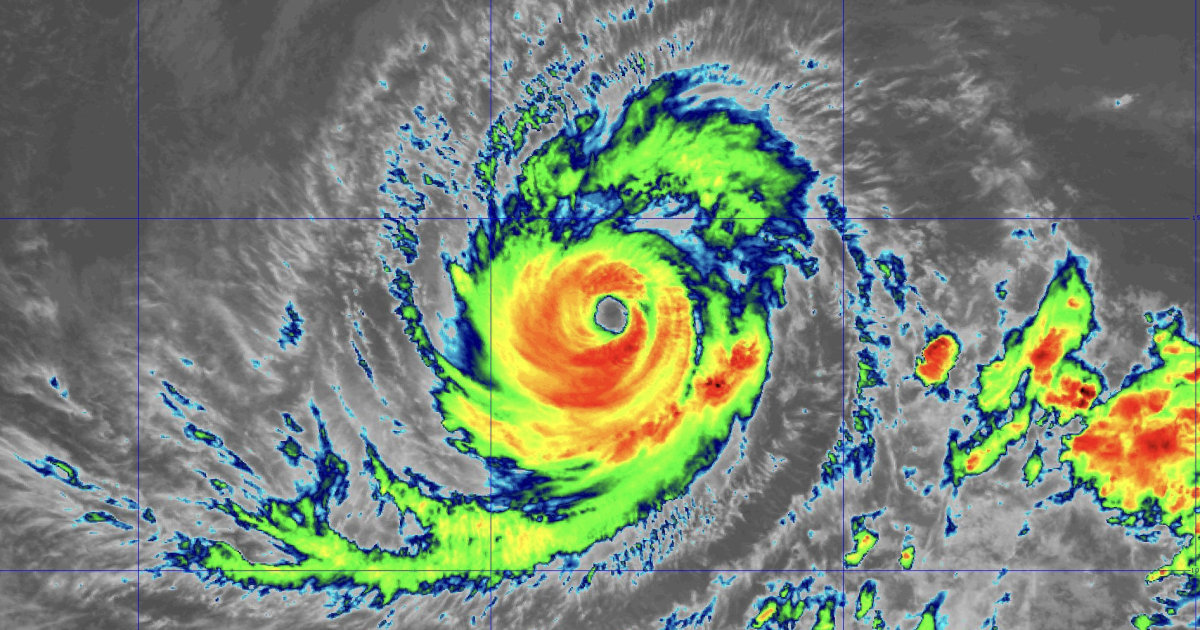
Hawaii declared a state of emergency as Hurricane Lowell churned toward the island chain, threatening heavy rain, dangerous surf and possible mudslides even as forecasts kept the storm’s center offshore.
The first impacts were expected as soon as Monday. Lowell, the third storm in just over three weeks to threaten Hawaii during an active central Pacific hurricane season, had weakened to a Category 3 hurricane by early Sunday, with sustained winds of 125 mph while moving northwest at 6 mph, The Guardian reported. A day earlier, the National Hurricane Center said Lowell had reached Category 5 strength overnight Friday before weakening to Category 4, with sustained winds of 145 mph about 640 miles south-southwest of Honolulu.
Forecasters expected Lowell to reach Hawaii as a Category 2 hurricane. Its center could pass roughly 130 miles west of Ni’ihau or 170 miles west of Kauai between Monday evening and Tuesday morning, according to the forecast cited by The Guardian. The National Hurricane Center’s earlier forecast cone showed Lowell passing just west of the major Hawaiian islands from south to north Monday night.
Officials warned that an offshore track would not eliminate the danger. Lowell could still bring as much as 10 inches of rain to Kauai and up to 8 inches to Maui, the National Hurricane Center said. The storm was also expected to generate life-threatening waves for parts of the island chain. A tropical storm warning was in effect for Kauai and Ni’ihau, where wind gusts above 39 mph were possible over the next 48 hours.
“Just because we’re on the edge of the cone doesn’t mean we’re safe,” John Bravender, warning coordination meteorologist at the National Weather Service, said at a Friday news conference.
Gov. Josh Green said the state was preparing before conditions worsened, with particular attention on Kauai County. “We are taking Hurricane Lowell extremely seriously and preparing now, before conditions deteriorate,” Green said in a statement Friday. “I urge everyone, especially those in Kauaʻi County, to complete their preparations, follow official alerts and stay away from floodwaters, dangerous surf and other hazardous areas.”
The governor’s office said Hawaii was securing harbors, deploying emergency personnel to strategic locations and monitoring dams for possible breaches or overflows.
Lowell follows recent storms that have already affected the islands. The Guardian reported that Tropical Storm Moke struck southern parts of Hawaii two weeks ago, bringing heavy rain and strong winds, just days after Hurricane Lala hit the region. Green said Lala alone caused at least $43 million in infrastructure damage on the Big Island and another $4.6 million in damage to homes. NBC News reported that parts of Oahu and the Big Island were hit with intense flooding and strong winds from Tropical Storm Lala last month.
The broader Pacific remained unusually active. As of Saturday, Hurricanes Karina, Lowell and Marie were all churning in the Pacific at the same time, The Guardian reported, marking the region’s first triple-hurricane stretch in a decade. The National Hurricane Center was also monitoring a fourth potential system off Mexico. Karina, a former Category 4 hurricane, was about 755 miles east-northeast of Hilo, Hawaii, while Tropical Storm Marie was about 705 miles west of the southern tip of Baja California and could produce high surf for Southern California during the holiday weekend, NBC News reported.
Colorado State University said the northeast Pacific hurricane season had produced 15 named storms to date. Daniel Gilford, a meteorologist and atmospheric scientist at Climate Central, told NBC News that warm El Niño sea surface temperatures are helping fuel stronger tropical cyclones. “If we have extra fuel, we can push the accelerator down more and these storms can become more intense as a result,” he said.
The United Nations warned Thursday that El Niño is “being supersized before our eyes” and said the world is in “the danger zone of extreme weather,” according to The Guardian. NOAA has previously warned there is a 69% chance this El Niño will be the strongest in 70 years.





Be First to Comment