Key takeaways:
- National Hurricane Center issued warning for dangerous surf and rip currents along the East Coast
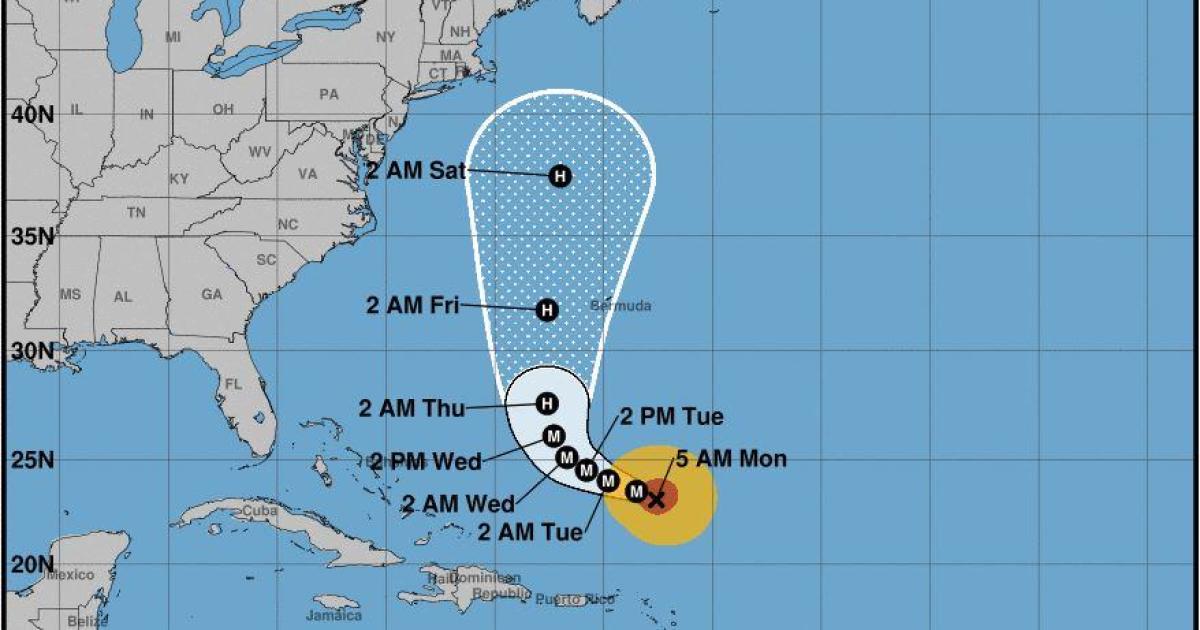
- Hurricane Lee located 340 miles north of the northern Leeward Islands with maximum sustained winds of 120 mph
- Lee expected to remain a major hurricane this week, turning north midweek and passing between Bermuda and the East Coast by the end of the week
Residents of the eastern United States are being warned to prepare for hazardous surf and rip current conditions as Hurricane Lee intensifies in the western Atlantic.
The National Hurricane Center issued a warning early Monday morning that dangerous surf and rip currents have already begun to affect the southeastern U.S. coast and will spread northward along the East Coast in the coming days.
At 5 a.m. ET, Hurricane Lee was located about 340 miles north of the northern Leeward Islands, with maximum sustained winds of 120 miles per hour. The storm is moving northwest at 7 miles per hour and is expected to remain a major hurricane this week, steadily strengthening over the next day or two.
Forecasters said Lee will turn to the north midweek and weaken as it passes in between Bermuda and the East Coast by the end of the week. However, the storm is predicted to stay offshore as it passes by New York City.
Residents of the eastern United States are advised to take precautions and stay informed of the latest updates from the National Hurricane Center.


Be First to Comment